


Staff................
For the past 5 years Orion has utilized a teaming approach to handle a variety of large survey projects. These projects have included everything from a detailed pre-design topographic and boundary survey for the Burlington Northern Santa Fe rail yard in Vancouver, Washington to providing photo and airborne GPS control for an AT&T fiber optics cable from Northern Washington to Southern Oregon. Our project surveyors take an active daily role in both field and office work ensuring the quality of our products. We do not have a multi-level management structure with redundancies that drive up project costs. The project surveyor is responsible for all aspects of management and technical tasks. These efficiencies are reflected in both the cost and quality of our work.
Utilizing the latest in survey technology Orion GPS is capable of efficiently performing most surveys with a single person, adding personnel as the situation demands. Orion’s proven ability to quickly mobilize multiple field crews and office operations on short notice, with all of the skills and equipment required, allow an immediate response to the needs of the most complex projects. A history of successful working relationships with surveying firms covering the west coast make a rapid deployment of crews to far flung locations possible.
"I have worked with John on numerous successful projects over the past 9 years. Johns' passion for surveying has given him an unfair edge on the competition. He has an uncanny ability to figure out how to best use technology as a tool to accomplish any project in the most economically feasible manner. John is also just plain easy to work with and that makes what some may consider drudgery, actually enjoyable."
Doyle L. Anderson, P.L.S.
Representative Experience:
GPS
Port of Portland Municipal Airports, Oregon. John was the Project Surveyor for this Port of Portland mapping and control project. The effort was part of the Port of Portland’s effort to develop an entire control network and storm drainage as-built drawings for each of its three municipal airports in Hillsboro (PHA), Troutdale (PTA), and Mulino (PMA). The first stage involved running a precise traverse through the existing site control and then tying each runway edge light. At PHA, this was completed with the standard 2-person field crew. At both PTA and PMA, John performed this task alone with the use of robotics. The traverse data was reduced and the resulting runway edge light locations were used to determine runway centerline by best-fit methods. Differential levels were run through the control points to obtain the highly accurate elevation data needed for airport control. Finally, John used real time kinematic GPS to map all of the existing storm drainage systems. This resulted in local coordinates, based on runway centerline, within the required one-tenth of a foot precision required for the project
Running "Y" Ranch, Klamath County, Oregon. John was the Project Surveyor for GPS work on this 9,600-acre ranch in southern Oregon. He managed field operations and all office work required deriving over 40 GPS control points.
O.D.O.T. Project GPS, Northwestern Oregon. Geodetic azimuth pairs were set at various Oregon Department of Transportation (O.D.O.T.) projects throughout Region 2 in northwestern Oregon. In the role of Project Surveyor, John supervised field operations on site and performed all office operations associated with each project. At each site, GPS observations were made to tie into existing geodetic control. Differential levels were run from nearby benchmarks. If no benchmark was found near the project, GPS observations were made to link the site control to distant vertical control. As a final check, conventional observations were made between each azimuth pair. O.D.O.T. was supplied with a detailed report for each project containing both ground and state plane coordinates for each control pair.
John D. Putnam, PLS
EDUCATION:
REGISTRATIONS & CERTIFICATIONS:
-
- BS, Geographical Science
- Oregon State University
- Defense Mapping Agency School
- U.S. Department of Defense
PROFESSIONAL AFFILIATIONS:
-
- Professional Land Surveyor Oregon No. 2676
- 40 hour O.S.H.A. HAZWOPER Certification
PROFESSIONAL EXPERIENCE:
Defense Mapping Agency
-
- Professional Land Surveyors of Oregon
- American Congress on Surveying & Mapping
W&H Pacific, Inc.
-
- Photogrammetrist, July 1991 to July 1992
Orion GPS, Inc.
-
- Survey Technician, November 1989 to June 1991
- Survey Technician, July 1992 to July 1994
- Project Surveyor, July 1994 to February 1998
SURVEY EXPERIENCE:
-
- President, February 1998
-
- Construction StakingTopographic Surveys
- Boundary and Right-of-Way Surveys
- American Land Title Association (ALTA) Surveys
- Boundary line Adjustments, Partition, and Subdivision Platting
- Aerial Photography Control Surveys
- Global Positioning Systems (GPS) Control Surveys
- Real Time Kenimatic (RTK) GPS Surveys
- Airborne GPS Control Surveys
- Hydrographic Surveys
- Photogrammetry
- Geographic Information Systems (GIS)
TOPOGRAPHIC
Union Pacific Railroad Stockton, Stockton, Lodi, & Galt California.Client: HDR, Inc. through Anderson-David & Associates. Orion GPS, Inc., teamed with Anderson-David & Assoc. and OribiTech, LLC. to provide pre-design topographic mapping of approximately ten (10) miles of main line railroad at 4 sites. Orion GPS’s responsibilities included; setting GPS control at each of the 4 sites, surveying approximately five (5) miles of main line utilizing a robotic total station and preparing final mapping product of two (2) of the sites.
Union Pacific Railroad Cima, Cima California.Client: HDR, Inc. through Anderson-David & Associates. Orion GPS, Inc. utilized RTK GPS to provide pre-design topographic mapping for approximately five (5) miles of main line railroad in the Mohave Desert.
Union Pacific Railroad Mococco Grade Crossing, Martinez, CA. Client: HDR, Inc. through Anderson-David & Associates. Orion GPS, Inc., teamed with Anderson-David & Associates to provide pre-design topographic mapping of approximately 5,000 feet of main line and the associated siding and yard tracks in this industrial area. Utilizing two (2) Robotic total stations operated by one person crews the area was controlled and mapped in less than three (3) days. Data was transmitted to HDR in Intergraph format to be used in the immediate design of a new crossing and the future realignment of the mainline track.
Portland & Western Railroad Crossing at Berwick Rd., Lake Oswego, Oregon. Client: Oregon Dept. of Transportation through HDR, Inc. Orion provided pre-design topographic mapping for the crossing improvement project in residential Lake Oswego.
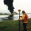
Union Pacific Operable UNH Cap, The Dalles, Oregon.Client: Divine Dutra, Inc. As Project Surveyor for this pre-construction and post-construction hydrographic survey, John was involved in both field and office operations. Because of the density and accuracy required, real time kinematic GPS (RTK) was used to obtain a positional once a second and aid in boat navigation. Depth soundings were collected digitally at the precise time the RTK readings were taken. Due to the lack in availability of software to combine the RTK and fathometer data, John developed a project specific package that merged both data sets to produce 3-dimensional coordinates on the riverbed. Truly a creative solution to a difficult problem.
Level 3, Seattle to Boise City Pair Base Line Mapping, Union, Baker & Malheur Counties, Oregon. Client: Level 3, Inc. Orion GPS, Inc. utilized RTK GPS to provide base line mapping for approximately 50 miles of this nation wide fiber optics data transmission and communications network. The base line mapping will be used as a backbone for the comprehensive GIS required to operate and maintain the system.
Level 3, Seattle to Boise City Pair BLM Crossing Location, Baker & Malheur Counties, Oregon. Client: Level 3, Inc. Orion GPS, Inc. delineated where Level 3’s running line crossed into and out of 19 parcels of public lands managed by the U.S. Bureau of Land Management (BLM) in over 20 separate sections. The crossings were located by actual sectional breakdown were sufficient existing government corners where recovered or by use of the BLM’s Geographic Coordinate Database (GCDB). Both RTK and mapping grade GPS were utilized in this project.
BOUNDARY, RIGHT-OF-WAY, PARTITIONS, and SUBDIVISIONS
American Can - Calpooya 69/115 KV Transmission Line, Linn County, Oregon. John was the Project Surveyor for this five-mile transmission line construction project for Pacific Power & Light (PP&L). Responsibilities included topographic surveying and base mapping for design, preparation of legal descriptions and exhibit maps for right-of-way acquisition, preparation of final construction plans, and construction staking. The project required extensive coordination with the Oregon Department of Transportation, local utility companies, and PP&L's engineering and right-of-way staff. Quick response in delivery of products and services were essential as the project had a very short window between conception and the required completion date.
Target Regional Distribution Center, City of Albany, Oregon. The project entailed commercial site development for a regional distribution center for Target that included a 14-acre building. As Project Surveyor, John was responsible for field and office operations. This project required a full boundary and topographic survey for design purposes, property line adjustment, and a major partition plat creating parcels for the distribution center site as well as future development.
AirTouch, Oregon & Washington. As part of their cell site densification program, AirTouch Cellular required the services of a surveyor to provide boundary and topographic mapping as well as construction staking at over 20 sites. Acting as Project Surveyor, John managed all aspects of field and office work. At each site, crews used GPS to derive accurate geodetic control required by the FCC & FAA. The field crews collected topographic data to map the proposed site and determined elevations of structures that might interfere with the cell site operation. In the office, the GPS and topographic data were processed and a base map developed. The boundary of the parent parcel was then resolved and added to the base map along with any existing easements and land use zoning information. When AirTouch accepted the final site location, legal descriptions and exhibits were prepared for the lease site and required easements. Before construction, the field crew laid out the site limits, the center of the cell structure, and an azimuth mark for true north.
MAPPING and CONSTRUCTION
Yaquina Head Outstanding Natural Area, Lincoln County, Oregon. John was the Project Surveyor responsible for directing both field and office operations including topographic mapping, utility easements, and preliminary building location staking, for the BLM's interpretive center on the near Newport on the Oregon Coast.
Olympic National Forest Sites, Olympic National Forest, Washington. As Project Surveyor, John was responsible for coordinating crew activities in remote locations required for topographic mapping of sites throughout the Olympic National Forest. Through the Federal Highway Administration’s Western Lands Division, he coordinated the office efforts needed to meet the Forest Service’s product and scheduling needs.
Northwest Pipeline, various sites throughout the Northwest. John has been involved in a number of natural gas transmission lines projects. He has been responsible for the preparation of topographic surveys, calculating proposed centering, planning and processing GPS missions, and the preparation of legal descriptions and exhibits.
Burlington Bottoms, Multnomah County, Oregon. John was responsible for developing photogrammetric control and additional pick-up topographic survey work on this 417-acre Bonneville Power Administration wetland mitigation site. John was also responsible for developing a Geographical Information System used to analyze the relationship between invader wetland vegetation species and the desired natural wetland vegetation. The project received the 1994 ASLA Sustainable Design Award and the 1995 CECO Engineering Excellence Grand Award.
HYDROGRAPHIC
Union Pacific Operable UNH Cap, The Dalles, Oregon. As Project Surveyor for this pre-construction and post-construction hydrographic survey, John was involved in both field and office operations. Because of the density and accuracy required, real time kinematic GPS (RTK) was used to obtain a positional once a second and aid in boat navigation. Depth soundings were collected digitally at the precise time the RTK readings were taken. Due to the lack in availability of software to combine the RTK and fathometer data, John developed a project specific package that merged both data sets to produce 3-dimensional coordinates on the riverbed. Truly a creative solution to a difficult problem.
James River Ewana Mill, City of Rainier, Oregon. John was instrumental in both field and office hydrographic operations for this deep-water barging feasibility study for this James River Corp. facility. Post-processed Kenimatic GPS was used to acquire positional fixes for sounding data.
James River Camas Slough, Camas, Washington. John was involved with field and office operations for this hydrographic survey of 1.6 miles of Camas Slough. The project extended from the James River facility at Camas into the Columbia River. He utilized static GPS to establish shoreline control for aerial mapping and later used post processed kinematic GPS to determine positional fixes for digital sounding observations.
Questions? E-mail info@oriongps.com
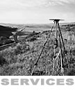
...........HOME | SERVICES | WORK SAMPLES | RACING
All materials copyright © OrionGPS, Inc. 2002
Last revised Monday, March 10, 2003